The Persian empire is considered to be one of the most powerful empires of the ancient world. At the height of its power, during the reign of Darius I the Great, the empire controlled more than 2.9 million square miles (7.5 million square kilometers) of land, and spanned three continents: Asia, Africa and Europe. Its control extended eastward into India and reached westward to Greece. The great capitals of ancient Persia were Persepolis and Susa, with their kings sometimes residing in Babylon. It is estimated that in 480 B.C. the empire had 50 million people living under its control. This huge amount was roughly 44% of the world's population at the time, making the Persian Empire the largest empire by population percentage.
The largest boundaries of the Empire of Persia around 490 BC were as follows:
1. The Northern Boundary were the Black Sea and the Caspian Sea.
2. The Western Boundary was the edge of Greece.
3. The Eastern Boundary were the cities north of India.
4. The Southern Boundary went all the way to Libya and Egypt.
For more information, click here: http://www.biblestudy.org/maps/persian-empire-at-its-height.html
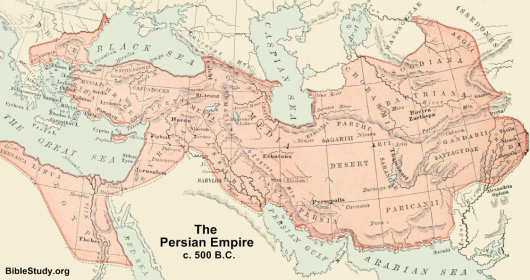
